

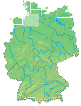
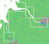
Germany > Elbe (km 685-657)
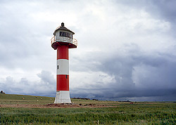
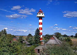
Osterende (Unterfeuer)
B 1457.5Position 53° 51' N | 009° 20' E
Operating 1984-
Height of focal plane 20 m
Height of structure 21 m
Range White 11 sm
Charakteristic Iso W 4 sec
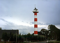
Osterende (Oberfeuer)
B 1457.51Position 53° 51' N | 009° 21' E
Operating 1984-
Height of focal plane 36 m
Height of structure 38 m
Range White 15 sm
Charakteristic Iso W 4 sec + L Fl WR 12 sec
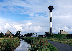
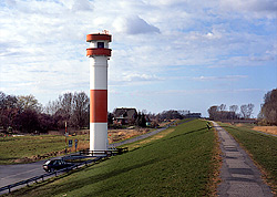
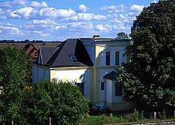
Brokdorf (Oberfeuer)
B 1460Position 53° 51' N | 009° 21' E
Operating 1982-
Height of focal plane 44 m
Height of structure 46 m
Range White 22 sm
Charakteristic Iso W 4 sec
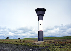
Hollerwettern (Unterfeuer)
B 1458Position 53° 50' N | 009° 20' E
Operating 1982-
Height of focal plane 21 m
Height of structure 22 m
Range White 19 sm
Charakteristic Iso W 4 sec
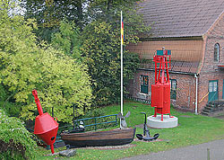
Hollerwettern (Alter Leuchtturm)
Position 53° 50' N | 009° 21' E
Operating 1911-1982
Height of focal plane 15 m
Height of structure 18 m
Range -
Charakteristic - (gelöscht)
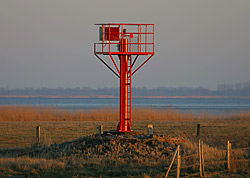
Rhinplate (Nord)
B 1468Position 53° 48' N | 009° 23' E
Operating 1954-
Height of focal plane 11 m
Height of structure 14 m
Range White 6 sm Red 4 sm Green 3 sm
Charakteristic Oc WRG 6 sec
Glückstadt (Unterfeuer)
B 1456Position 53° 48' N | 009° 24' E
Operating 1937-
Height of focal plane 15 m + 15 m
Height of structure 17 m
Range White 19 sm + White 4 sm Red 3 sm Green 2 sm
Charakteristic Iso W 8 sec + Oc WRG 6 sec
Glückstadt (Oberfeuer)
B 1456.1Position 53° 48' N | 009° 24' E
Operating 1937-
Height of focal plane 30 m
Height of structure 33 m
Range White 21 sm
Charakteristic Iso W 8 sec
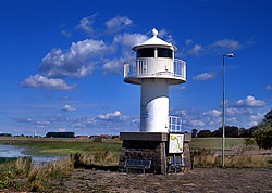
Glückstadt (Nordmole)
B 1476Position 53° 47' N | 009° 25' E
Operating 1995-
Height of focal plane 9 m
Height of structure 7,5 m
Range White 9 sm Red 7 sm Green 6 sm
Charakteristic Oc WRG 6 sec
Wischhafen
B 1469Position 53° 47' N | 009° 21' E
Operating 2003-
Height of focal plane 9 m
Height of structure 7 m
Range White ? sm Red ? sm Green ? sm
Charakteristic
Wischhafen (Altes Ansteuerungsfeuer)
Position 53° 47' N | 009° 21' E
Operating 1932-2003
Height of focal plane 7 m
Height of structure 7 m
Range -
Charakteristic - (gelöscht)
Krautsand (Unterfeuer)
B 1482Position 53° 43' N | 009° 23' E
Operating 1978-
Height of focal plane 20 m
Height of structure 23 m
Range White 13 sm
Charakteristic Iso W 4 sec
Krautsand (Oberfeuer)
B 1482.1Position 53° 43' N | 009° 23' E
Operating 1908-
Height of focal plane 35 m
Height of structure 36 m
Range White 13 sm
Charakteristic Iso W 4 sec
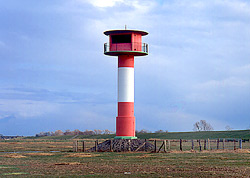
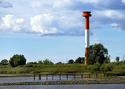
Ruthensand (Unterfeuer)
B 1474Position 53° 43' N | 009° 26' E
Operating 1955-
Height of focal plane 15 m
Height of structure 15 m
Range White 11 sm
Charakteristic Iso W 4 sec + Oc WRG 6 sec
Bielenberg (Alter Leuchtturm)
Position 53° 44' N | 009° 28' E
Operating 1907-1982
Height of focal plane 14 m
Height of structure ? m
Range -
Charakteristic - (gelöscht)
Steindeich
B 1490Position 53° 44' N | 009° 28' E
Operating 1966-1995
Height of focal plane 37 m
Height of structure 35 m
Range -
Charakteristic - (gelöscht)
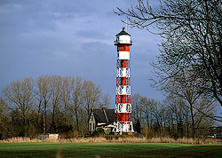
Kollmar (Oberfeuer)
B 1501.1Position 53° 44' N | 009° 29' E
Operating 1986-
Height of focal plane 40 m
Height of structure 40 m
Range White 16 sm
Charakteristic Iso W 8 sec
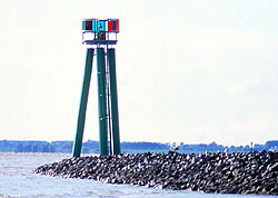
Krückau
B 1509Position 53° 43' N | 009° 31' E
Operating 1969-
Height of focal plane 8 m
Height of structure 8 m
Range White 6 sm Red 4 sm Green 3 sm
Charakteristic F WRG