
Belgium
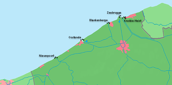
Belgium has a short coast line of about 60 km located in the northwest corner of the nation between the Netherlands and France. The coast line lies in the flemish-spoken parts of the country. Important trading ports are Zeebrugge and Oostende.
The belgium coast is a cornerstone in the early beginnings of building aids to navigation. In the late middle ages the european trading routes passed this coast, so that Nieupoort, Oostende and Blankenberge became very important trading outposts for seafarers. Light beacons have been established here very early, a first lighthouse in Nieuwpoort is reported to have been lit in 1284. In later centuries Oostende became an important harbour for trading ships across the north atlantic, whereas the other towns became famous vacation cities in the 18th century.
The belgium harbour cities suffered major destruction in both world wars, and most of all existing lighthouses had to be rebuild in the late 1940s. The lighthouse in Oostende, called »Lange Nelle«, is the fifth to serve on this location.
In Flemish lighthouses are referred to as Vuurtorens (»fire tower«), lightships are referred to as lichtschipen.

17
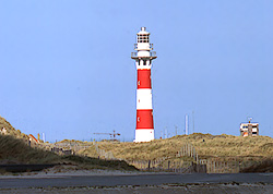
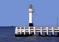
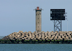
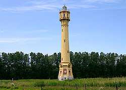
Nieuwpoort
B 0074Position 51° 09' N | 002° 44' E
Operating 1949-
Height of focal plane 28 m
Height of structure 29 m
Range Red 16 sm
Charakteristic Fl (2) R 14 sec
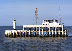
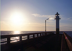
Nieuwpoort (Pier West)
B 0075Position 51° 09' N | 002° 43' E
Operating
Height of focal plane 12 m
Height of structure ? m
Range Green 9 sm
Charakteristic F G
Nieuwpoort (Pier Oost)
B 0076Position 51° 09' N | 002° 43' E
Operating
Height of focal plane 12 m
Height of structure m
Range Red 10 sm
Charakteristic F R
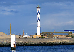
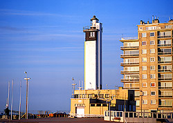
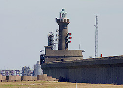
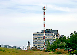
Oostende
B 0092Position 51° 14' N | 002° 56' E
Operating 1949-
Height of focal plane 65 m
Height of structure 58 m
Range White 27 sm
Charakteristic Fl (3) W 10 sec
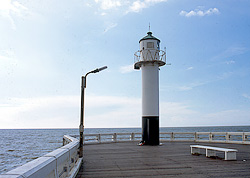
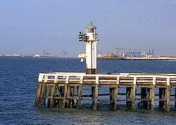
Oostende (Pier West)
B 0094Position 51° 14' N | 002° 55' E
Operating ?-
Height of focal plane 14 m
Height of structure ? m
Range Green 10 sm
Charakteristic F G
Oostende (Pier Oost)
B 0096Position 51° 14' N | 002° 55' E
Operating
Height of focal plane 15 m
Height of structure ? m
Range Red 12 sm
Charakteristic F R
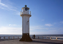
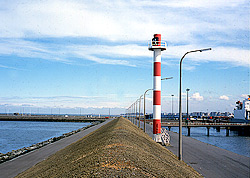
Blankenberge
B 0112Position 51° 19' N | 003° 06' E
Operating 1949-
Height of focal plane 32 m
Height of structure ? m
Range White 20 sm
Charakteristic Fl (2) W 8 sec
Blankenberge (Pier West)
B 0113.4Position 51° 19' N | 003° 07' E
Operating ?-
Height of focal plane 16 m
Height of structure 9 m
Range Green 12 sm
Charakteristic F G
Blankenberge (Pier Oost)
B 0114Position 51° 19' N | 003° 07' E
Operating ?-
Height of focal plane 14 m
Height of structure 8 m
Range Red 11 sm
Charakteristic F R
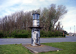
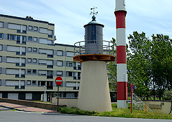
Zeebrugge (Alter Molenturm)
Position 51° 19' N | 003° 07' E
Operating ?-?
Height of focal plane ? m
Height of structure 3 m
Range -
Charakteristic - (gelöscht)
Zeebrugge
B 0122Position 51° 21' N | 003° 12' E
Operating 1907-
Height of focal plane 24 m
Height of structure ? m
Range White 20 sm Red 18 sm
Charakteristic Oc WR 15 sec
Zeebrugge (Mole Oost)
B 0123Position 51° 22' N | 003° 12' E
Operating 1983-
Height of focal plane 33 m
Height of structure ? m
Range Red 7 sm
Charakteristic Oc R 7 sec
Zeebrugge (Mole West)
B 0123.2Position 51° 22' N | 003° 12' E
Operating 1983-
Height of focal plane 33 m
Height of structure ? m
Range Green 7 sm
Charakteristic Oc G 7 sec
Zeebrugge (Laag)
B 0124Position 51° 21' N | 003° 13' E
Operating 1983-
Height of focal plane 24 m
Height of structure ? m
Range White 8 sm
Charakteristic Oc W 5 sec
Zeebrugge (Hoog)
B 0124.1Position 51° 20' N | 003° 14' E
Operating 1983-
Height of focal plane 47 m
Height of structure ? m
Range White 8 sm
Charakteristic Oc W 5 sec
Knokke-Heist (Laag Licht)
Position 51° 20' N | 003° 14' E
Operating 1907-1983
Height of focal plane ? m
Height of structure ? m
Range -
Charakteristic - (gelöscht)
Knokke-Heist (Hoog Licht)
Position 51° 21' N | 003° 13' E
Operating 1907-1983
Height of focal plane ? m
Height of structure 34 m
Range -
Charakteristic - (gelöscht)